


Here we have described some recommended hikes in different distances and difficulty levels . This is only a small selection!
All hikes can be guided by us or undertaken independently. Also, especially the older dogs are happy when they come along on a hike.
What to bring?
- Summer: mountain or hiking boots, wind- or rainproof clothing if needed, thermos, mosquito repellent, map
- Winter: Winter boots, snowshoes, windproof clothing, extra sweater, thermos, in April/May: sunscreen (at least factor 15), map.

Hike up on Ørneberget/ Svartberget
A two to three hour hiking tour to the (house) mountain Ørneberget/(Eagle or Black Mountain). It is located on the northeast side by the husky farm.
Its black rock face heats up in the midday sun and creates strong updrafts. Eagles use these updrafts to rapidly gain altitude in large loops.
The 650 meter high mountain gives a good view over the lake Veslevatn, Innset and the Huskyfarm.

Hiking Rubben
Mount Rubben borders the Innset valley in a southwesterly direction. On its rounded top, a small transmission tower can be seen from Innset, which provides Innset with radio and cell phone coverage.
A hike to the 850 meter high Rubben takes about 2 – 4 hours. If children are with you in summer, you should calculate more time right away.

Hiking Innset-Altevatn-Innset
This hike to Lake Altevatn is basically up our sled trail. 200 meters of altitude it goes slowly but surely up. Now and then a red marker on the trees should point the way. In August/September you can find multe-, blueberries and mushrooms in this area.
To the left is the river from Altevatn to Veslevatn, which at the halfway point turns into an impressive canyon. At the top of Altevatn you walk over the dam to the road, on which you then walk back down to Innset.
The distance is about seven kilometers.
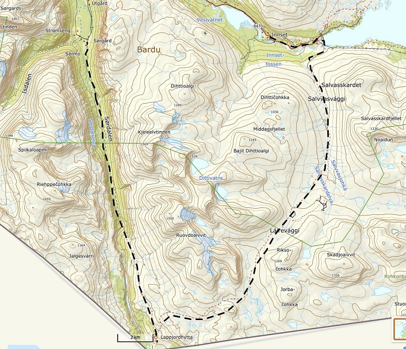
Hiking Sørdalen-Innset
This hike is sporty and lasts two days. To spend you can use a tent or spend the night in the Lappjordhytta of the hiking club.

Hiking to Koivasshytta
The path to Koivasshytta is a good five kilometers from the end of the road on the north shore of Altevatn. So it is easy for sporty children. The path is flat.
The small log cabin is open. A stove including firewood provides warmth and three beds can be used for overnight stays.
The distance there and back is ten easy kilometers.
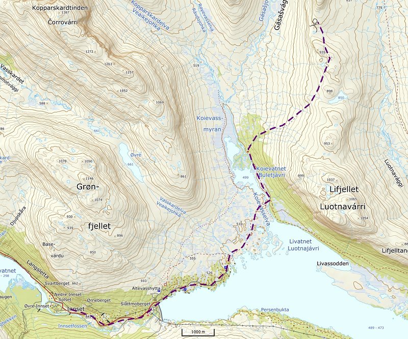
Hiking to the Reindeer marking at Lifjellet
The reindeer are usually collected at midnight during the first two weeks in July. Then it is the coolest. Since the reindeer are not collected every day, you should wait for a clear signal from the Sami so that you do not walk in vain.
First we go to Koivasshytta from the end of the road on the north shore of Altevatn. First you walk towards the rock face of Lifjellet, over a bridge that crosses Koievasselva and then along this river to the hut. This is reached after about five kilometers of level path.
From there, the trail goes uphill above the tree line, always following the tracks made by the Sami people with their quads and off-road motorcycles. After six kilometers we reach the gate where the reindeer are marked.
Very important: take warm clothes and hot drinks, because at night it gets really fresh up there!

Hike to the reindeer marking at Salvasskardet
The reindeer are usually collected at midnight in the days after 07 July. Since the reindeer are not collected every day, you should wait for a clear signal from the Sami, so that you do not walk in vain.
First we go to the lake Altevatn. Up to there you can also go by car. Then you have already saved almost four kilometers. On the south side of the dam, the trail goes directly to the Sami settlement, which is reached after about twelve kilometers. Not quite so far, i.e. below the Sami settlement, the large enclosure lies on the left.
A few years ago we made a short video of a reindeer marking.
Very important: take warm clothes and hot drinks, because at night it gets really fresh up there!
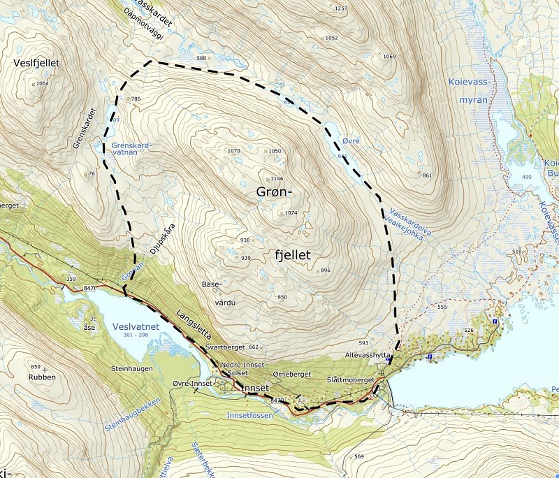
Hiking around Grønfjellet
First you drive or walk up the road to Lake Altevatn. At the dam you turn immediately left. At the end of the road you use a path uphill. The mountain Grønfjellet is well visible and the valley right next to it also. So you can’t go wrong. T
Only when it goes in southwestern direction around the mountain again towards Innset, the declimb becomes a bit more challenging. But before you go down to the lake Veslevatn, you have a great view. A small path to the left of the river leads steeply down. From time to time a look down to the river to the right is worthwhile: a really steep and narrow canyon! Here the river has eaten deep into the rocks. Soon the road at Veslevatn is reached and off we go to the Huskyfarm.
Six hours should be calculated for this tour in any case.